Saline di Trapani e Paceco
A centuries-old landscape of salt pans, windmills and coastal wetlands.
The Saline di Trapani e Paceco are historic working salt pans and protected wetlands south of Trapani, shaped by centuries of sea-salt production.
Key facts
Site type:
Comune:
Nature, Walking Route
Trapani, Paceco
District:
Nubia
The Saline di Trapani e Paceco form a distinctive coastal landscape of shallow evaporation ponds, canals, embankments and windmills south of Trapani. Salt has been produced here for centuries, taking advantage of the flat shoreline, intense summer sun, frequent winds and naturally saline Mediterranean waters.
The origins of salt production in the area are traditionally associated with the Phoenicians, although direct archaeological evidence for this early phase is lacking. The first clear written record dates to 1154, when the geographer al-Idrīsī described a salt pan outside Trapani. By the later Middle Ages the industry had become an important part of the city’s economy, and salt from the Trapanese coast was subsequently exported throughout the Mediterranean and beyond.
Traditional production relies on moving seawater through a sequence of increasingly concentrated basins until salt crystallises in the final ponds. Windmills historically pumped water between the basins and were also used to grind the harvested salt.
The landscape is equally important for wildlife. The shallow saline ponds provide feeding, resting and breeding habitats for large numbers of migratory and resident birds. In 1995 approximately 1,000 hectares were protected as the Riserva Naturale Orientata Saline di Trapani e Paceco, now managed by WWF Italy. Salt production continues within the reserve, preserving a rare landscape in which productive activity, industrial heritage and wetland conservation remain closely connected.
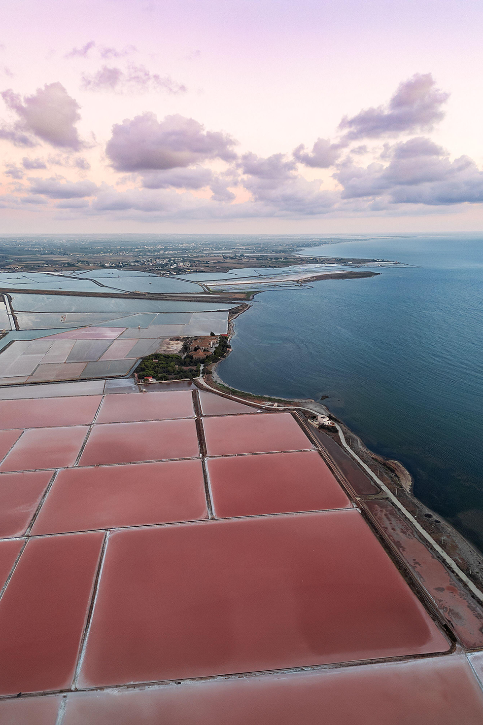
Photo: Amazing Aerial, Alamy
Explore further
Explore the long history of salt production around Trapani, the traditional system of evaporation ponds and windmills, and the transformation of a working coastal landscape into one of western Sicily’s most important protected wetlands.
From ancient tradition to medieval industry
The origins of salt production around Trapani are difficult to establish precisely. Local tradition and regional sources suggest that the exploitation of the coastal flats may have begun with the Phoenicians around three thousand years ago, but no direct material evidence has yet confirmed this early date.
The first secure written testimony comes from the Arab geographer al-Idrīsī. Writing for the Norman king Roger II in 1154, he recorded a salt pan immediately outside Trapani, demonstrating that organised salt production was already established by the twelfth century.
During the later Middle Ages the saline became increasingly important to the economy of Trapani. Concessions and leases encouraged the creation of additional saltworks along the coast, while the nearby harbour provided the means to export salt to markets across the Mediterranean.
By the early modern and nineteenth-century periods, salt had become one of the commodities most closely associated with Trapani and its maritime trade.
How the salt pans work
Traditional salt production depends on a carefully controlled sequence of evaporation. Seawater first enters large shallow basins, where exposure to the sun and wind begins to concentrate the dissolved salts. It is then transferred through successive ponds as its salinity increases.
The final stages take place in smaller crystallisation basins, where evaporation produces a layer of sea salt. During the summer harvest this salt is gathered and traditionally formed into large mounds to drain and dry before storage.
The shape, depth and arrangement of the basins are fundamental to the process. Narrow embankments separate the different stages, while channels and sluices regulate the passage of water through the system.
Although mechanical equipment is now used in parts of the saline, traditional methods continue to shape both the productive cycle and the appearance of the landscape.
The windmills
Windmills are among the most recognisable features of the Saline di Trapani e Paceco, but historically they were working machines rather than decorative elements.
Traditional tower mills used wind power to raise seawater from one basin to another, often through an Archimedean screw. Other mills were equipped with heavy stone machinery used to grind the harvested salt before it was prepared for sale.
Two principal types developed in the Trapanese salt landscape. The older star-shaped windmill used large canvas-covered wooden sails, while the later so-called American mill employed numerous smaller metal blades and could orient itself more easily to the wind.
Many historic mills eventually fell out of productive use as mechanical pumps and modern machinery were introduced. Surviving and restored examples nevertheless remain important evidence of the technology that sustained the salt industry for generations.
Salt pans and wildlife
The artificial basins created for salt production have also become an exceptionally valuable wetland habitat. Their different levels of salinity produce a mosaic of environments supporting specialised plants, invertebrates and large numbers of birds.
The saline lie on an important migration route between Europe and Africa. Avocets, black-winged stilts, herons, egrets, terns and numerous other waterbirds use the ponds for feeding, resting or breeding, while greater flamingos have become one of the most conspicuous species associated with the reserve.
The area was designated the Riserva Naturale Orientata Saline di Trapani e Paceco in 1995 and is managed by WWF Italy. It also forms part of the Natura 2000 network and was designated a Ramsar Wetland of International Importance in 2017.
Protection of the saline therefore depends not on removing human activity from the landscape, but on maintaining the relationship between traditional salt production and the habitats that have developed around it.
Sources & further reading
Explore the official, historical and environmental sources used to document the Saline di Trapani e Paceco, from the history and techniques of salt production to the windmills, wetland habitats and protection of the reserve.