Balio Gardens
Historic gardens created by Count Pepoli around the medieval Balio Towers
The Balio Gardens are historic public gardens at the summit of Monte Erice, created by Count Agostino Sieri Pepoli from 1872 around the medieval towers overlooking the Castle of Venus.
Key facts
Site type:
Comune:
Garden
Erice
District:
Historic centre
The Balio Gardens occupy approximately six hectares around the medieval Balio Towers at the summit of Monte Erice. Their name derives from the "bajulo", the official who represented sovereign authority and was historically associated with the towers, which also formed part of the fortified approach to the nearby Castle of Venus.
The present gardens originated in 1872, when Count Agostino Sieri Pepoli reached an agreement with the municipality to restore the medieval towers and transform the surrounding grazing land into a landscaped public garden. Opened to the public in 1881, the gardens were laid out largely in the English landscape tradition, with terraces, winding paths, wooded areas and planting adapted to the rocky terrain.
Pepoli also planted extensively beyond the formal garden, helping to transform previously open and scrub-covered slopes around the Balio and Runzi into woodland. Today the gardens combine mature trees and ornamental planting with native species characteristic of Monte Erice, while viewpoints overlook Trapani, the Egadi Islands, Monte Cofano and much of the historic Agro Ericino.
Over time the Balio also became a place of civic commemoration. Busts and monuments honour historians, writers, patriots and public figures associated with Erice, alongside the Monument to the Fallen and more recent memorials. Following extensive restoration and landscape works in the 2020s, the Balio remains one of the principal public spaces of the historic town.
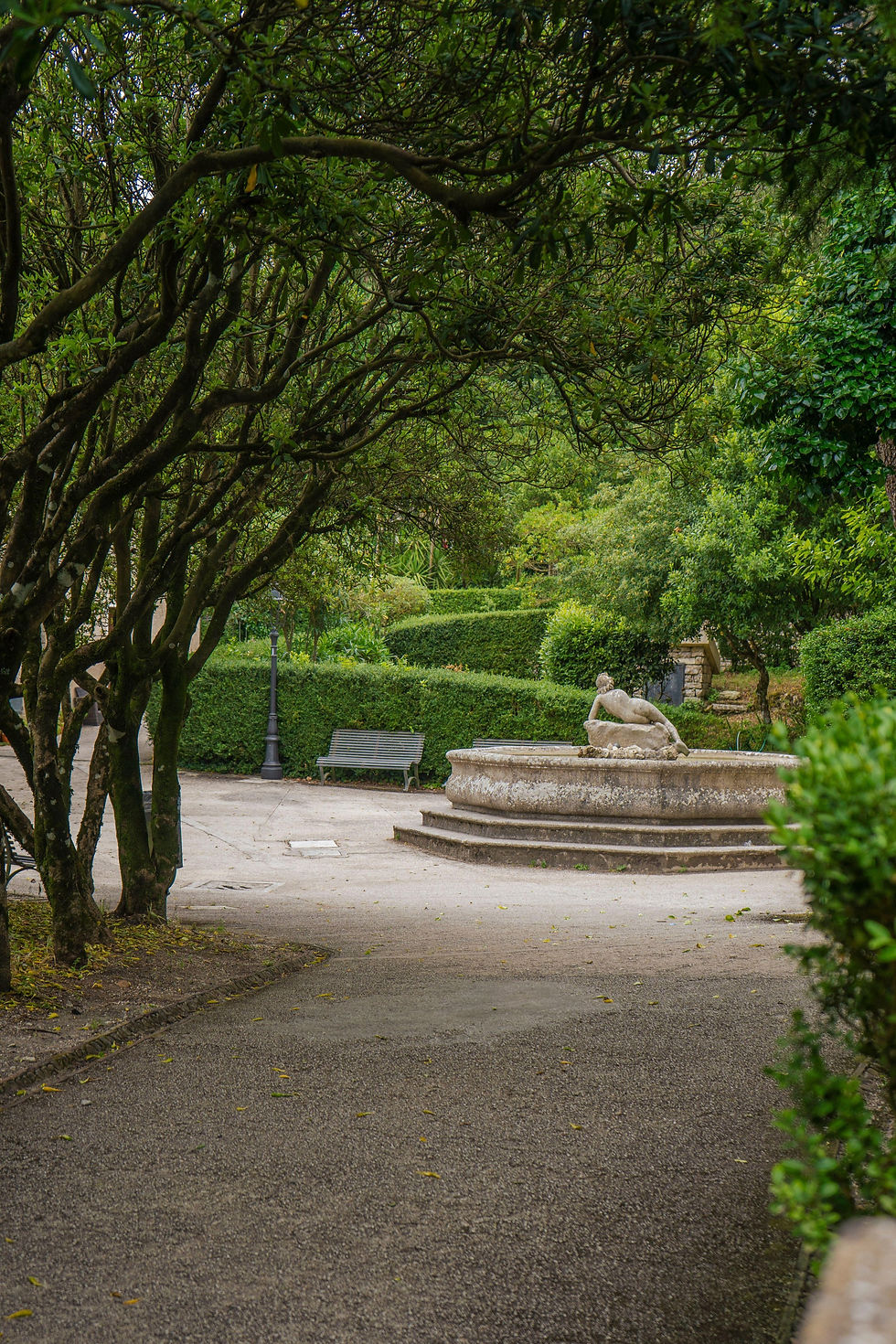
Photo: Libero Monterisi, Alamy
Explore further
Discover the history, architecture, archaeology, people and events connected with this place, with more detailed information about its origins, development and significance.
From medieval Balio to public garden
For centuries the area around the Castle of Venus had a defensive and civic role. The nearby towers take their name from the bajulo, an official representing sovereign authority, and were associated with the administration of medieval Monte San Giuliano as well as the fortified approach to the castle. By the nineteenth century, however, the towers and surrounding land had lost much of their earlier function.
A decisive change came in 1872, when Count Agostino Sieri Pepoli obtained use of the Balio Towers and surrounding grazing land through an agreement with the municipality. In return, Pepoli undertook the restoration of the medieval structures and the creation, at his own expense, of a garden intended for public use.
The resulting garden combined the medieval ruins with terraces, paths, planted areas and viewpoints. Its predominantly informal layout reflected the English landscape tradition, using the irregular topography and existing rocks as part of the composition rather than imposing a rigid geometrical plan. The gardens opened to the public in 1881.
Pepoli's own retreat, the Pepoli Turret, was constructed between 1872 and 1880 on a rocky spur immediately below the gardens. Together, the Turret, restored towers and landscaped grounds formed a picturesque ensemble around the Castle of Venus and gave the former defensive landscape a new public and cultural role.
Among the later additions to the gardens is the Fountain of Venus and the Bee, created in 1933 and attributed to Professor Quartana. Its imagery reflects the enduring association of Erice with Venus, whose ancient sanctuary occupied the summit beside the present Castle of Venus. The fountain was restored in 1975 by Giuseppe Lamia.
Creating a wooded landscape
The landscape surrounding the Balio was also considerably altered by nineteenth-century planting. Pepoli introduced trees not only within the garden but across neighbouring slopes, including areas around the Runzi that had previously been substantially more open, rocky or covered in scrub. Pines, walnuts, almonds and other species were among those planted.
This work contributed to the development of the wooded landscape now extending below the Castle of Venus and Pepoli Turret. Parts of these slopes form today's Bosco Sacro di Erice and Bosco dei Runzi, where surviving native woodland and later planting are now the subject of ecological conservation and restoration.
Within the Balio itself, cultivated vegetation has become closely integrated with native plants of Monte Erice. Holm oak, pine, laurel, myrtle and box occur alongside characteristic plants of the surrounding limestone cliffs, some of which have colonised the garden's walls and rocky areas.
Monuments and memory

During the twentieth and twenty-first centuries the Balio Gardens also developed into a place of civic memory. Busts and memorials distributed through the gardens commemorate people associated with the history, literature and public life of Erice.
Among the earliest historical figures represented is Antonio Cordici (1586–1666), the historian and antiquarian whose collections and writings helped establish the study of Erice's past and after whom the Cordici Museum is named.
The nineteenth century is represented by Giuseppe Vito Castronovo (1814–1893), Dominican priest, librarian and author of the extensive Erice, oggi Monte San Giuliano in Sicilia: memorie storiche; Giuseppe Coppola (1821–1902), the Ericine patriot who participated in the revolutions of 1848 and led local volunteers during Garibaldi's campaign of 1860; and Ugo Antonio Amico (1831–1917), poet, educator and author of works devoted to Ericine history, legends and culture.
A bust also commemorates Nunzio Nasi (1850–1935), the Trapanese politician and government minister closely associated with Erice, where he died. More recently, a bust of historian Giuseppe Pagoto was installed in 2020, while in 2026 a commemorative stele was dedicated to Pietro Ermelindo Lungaro (1910–1944), the Erice-born police officer and Resistance member killed in the Ardeatine massacre in Rome.
Together with the Monument to the Fallen, these memorials have made the gardens a record of the people and events through which Erice has chosen to commemorate its own history.
Looking across the Agro Ericino
The views from the Balio also reveal something of Erice's historical relationship with the territory below. Until the fragmentation of its territory during the nineteenth and twentieth centuries, Monte San Giuliano was the centre of an extensive agricultural and pastoral hinterland known as the Agro Ericino, covering almost 40,000 hectares between Trapani and the Gulf of Castellammare.
Much of the landscape visible from the gardens once belonged to this territory. Today it is divided principally among the municipalities of Erice, Valderice, Buseto Palizzolo, Custonaci and San Vito Lo Capo, with part belonging to Castellammare del Golfo. Mountains such as Monte Cofano and Monte Sparagio, together with the countryside and coastline stretching towards the Gulf of Castellammare, formed part of the wider historical landscape associated with Monte San Giuliano.
Writing in 1872—the same year that Pepoli began his transformation of the Balio—Giuseppe Vito Castronovo described the Agro Ericino as a landscape of feudi and contrade, cultivated land, pastures, woodland, springs and archaeological remains. The panorama from the gardens therefore looks out over a territory that was historically closely connected with the economic and civic life of the town on the mountain.
Restoration and the gardens today
The Balio Gardens have undergone a major programme of restoration and landscape improvement in recent years. A €1.6 million project included work to vegetation and paths, the removal of invasive species, measures to improve biodiversity and interventions intended to make the gardens more accessible.
Sources & further reading
Explore the historical sources, archaeological research, books, academic studies and official records used to document this place, with links for further reading and research.